Simple Start, Complex Finish
A bridge removal sparks a renaissance
DESIGNER
2021
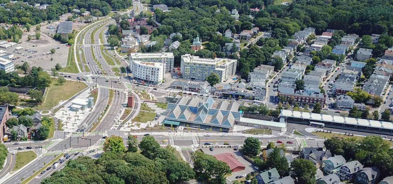
The Casey Arborway project in Boston started as a simple bridge inspection and possible deck replacement. However, it eventually became one of the most multifaceted and intricate planning and engineering undertakings by the Massachusetts Department of Transportation since the famous “Big Dig,” and one that dramatically transformed the Forest Hills neighborhood in Jamaica Plain.
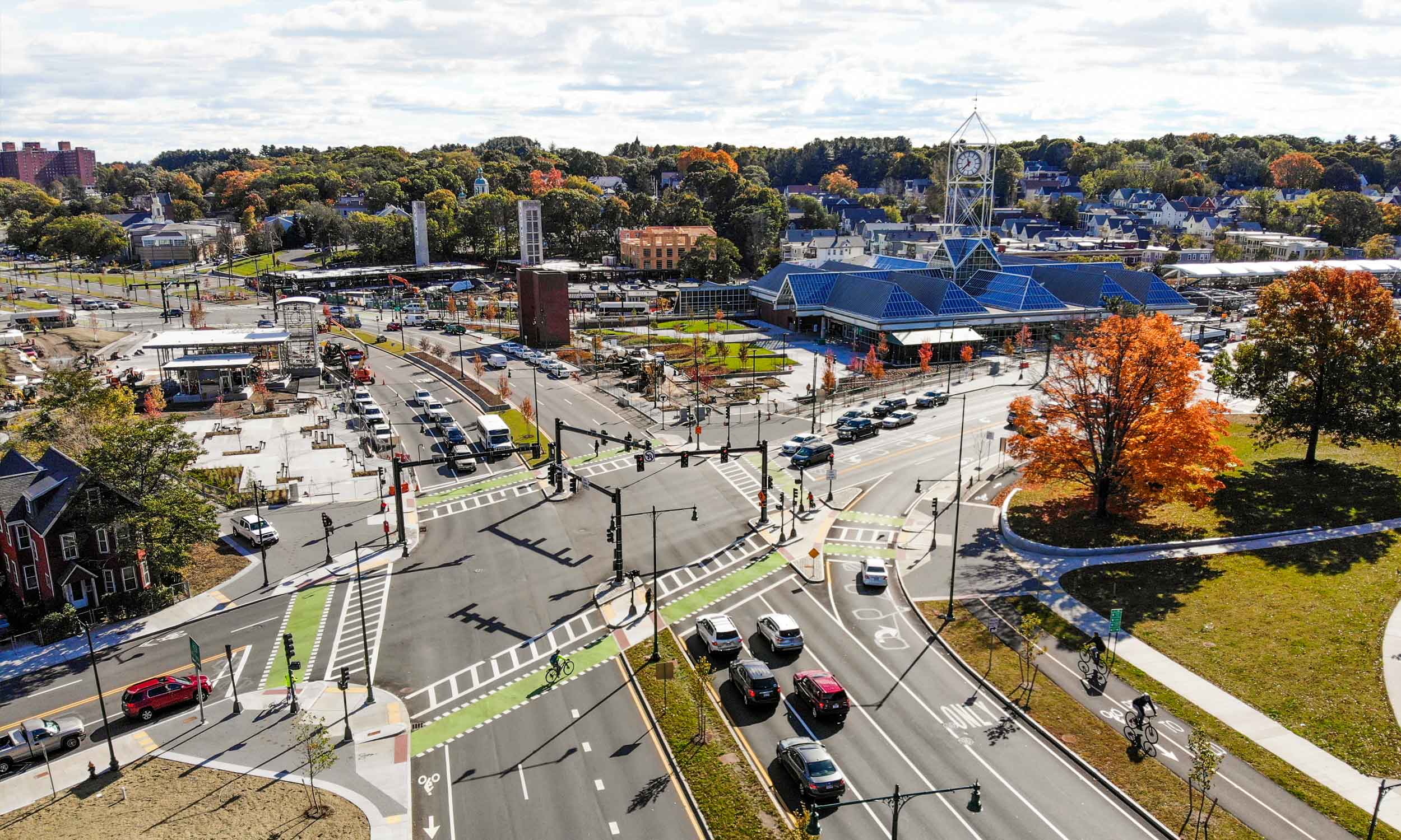
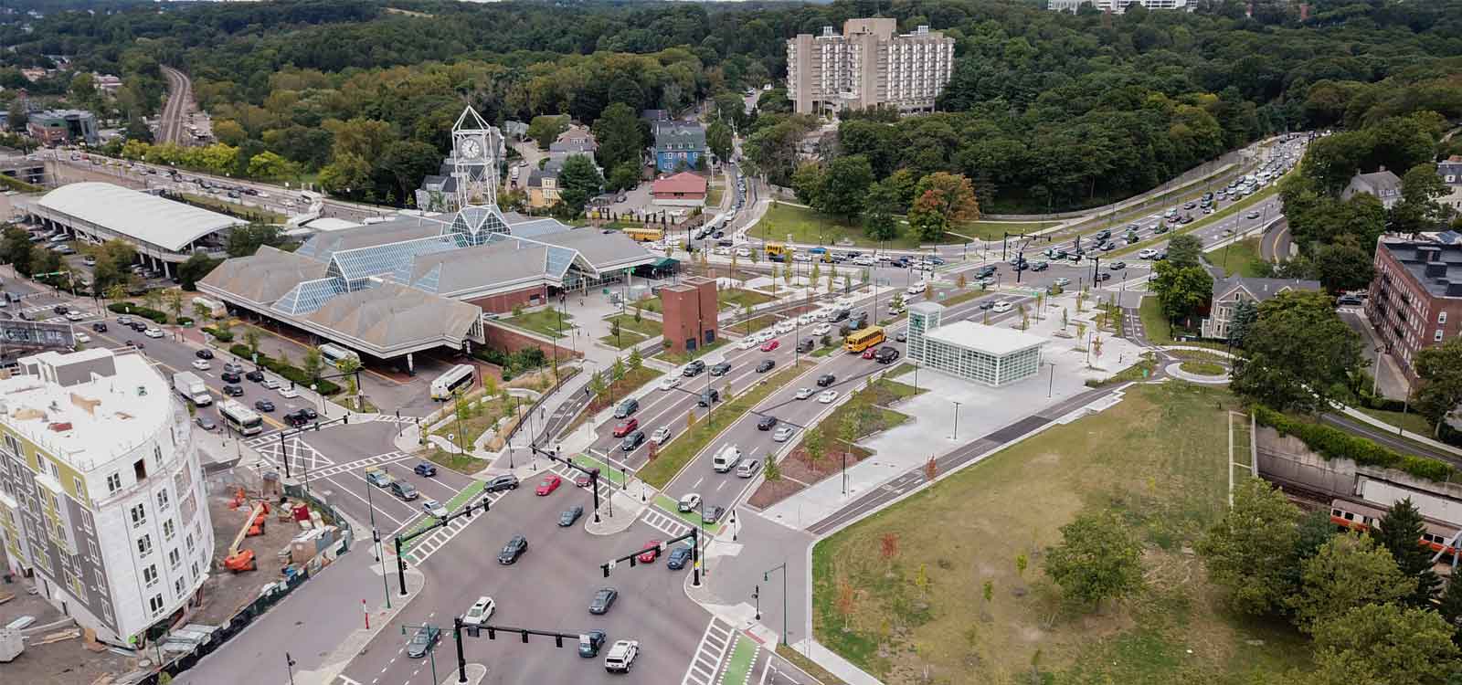
A crumbling, unnecessary overpass was demolished, and a new at-grade transportation system was created. A busy, multimodal hub was expanded and improved; water and rail tunnels were reconstructed; and pedestrian and bicycle facilities were developed. Now, Frederick Law Olmsted’s Emerald Necklace park system is reconnected, the urban streetscape renewed, and surrounding neighborhoods are seamlessly integrated into the historic greenway.
But it was not easy.
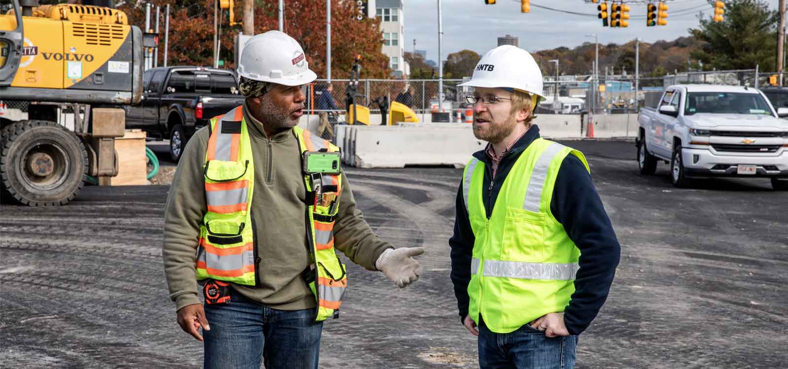
“Hands down, in my 31 years of working at HNTB, this was the most complicated and complex project that I’ve ever been involved in,” said Paul Godfrey, HNTB’s Northern New England office leader and the project’s design project manager.
“We didn’t have any preconceived notions with this project. We learned that it’s good to go through a public process, that what other people think, their comments, and working with stakeholders and neighborhoods is important. HNTB helped us keep the regional aspect, and the overall improvements to the community are too numerous to count.”
Steve McLaughlin, MassDOT Project Manager
A single vision for a multi-use space
Built in 1951, the underused William J. Casey overpass had become derelict.
“It was a bypass over a local roadway network built to get cars in and out of urban centers as fast as possible,” said Jonathan Kapust, HNTB’s engineering lead and construction project manager. “But the demand for the overdesigned viaduct never came, and it was causing more problems for the bisected neighborhoods than helping bypassing traffic.”
Over the past 100 years, that transportation network had become a patchwork of disconnected and inefficient modes.
“It was haphazard,” Godfrey said. “It created confusion, strange set ups for traffic signals, and turning movement that jammed local traffic.”
Bicyclists, pedestrians, commuter and local traffic, 16 transit bus routes, regional and national rail service, and school buses all converged in one area, which also included a subway terminal station, taxi stands, parking, a commercial business district, a transit bus maintenance facility, abutting homeowners, parks, and historic landmarks — and that was above ground. Beneath: three large water mains and a rail tunnel.
“A traditional mindset would have been, ‘Let’s just replace the bridge,’” Godfrey said. “But MassDOT said, ‘Wait a second. Let’s do a holistic planning process, look at all the modes involved, livability and mobility, and decide what a better answer would be. An at-grade network was the best solution.”
The Casey Arborway project included:
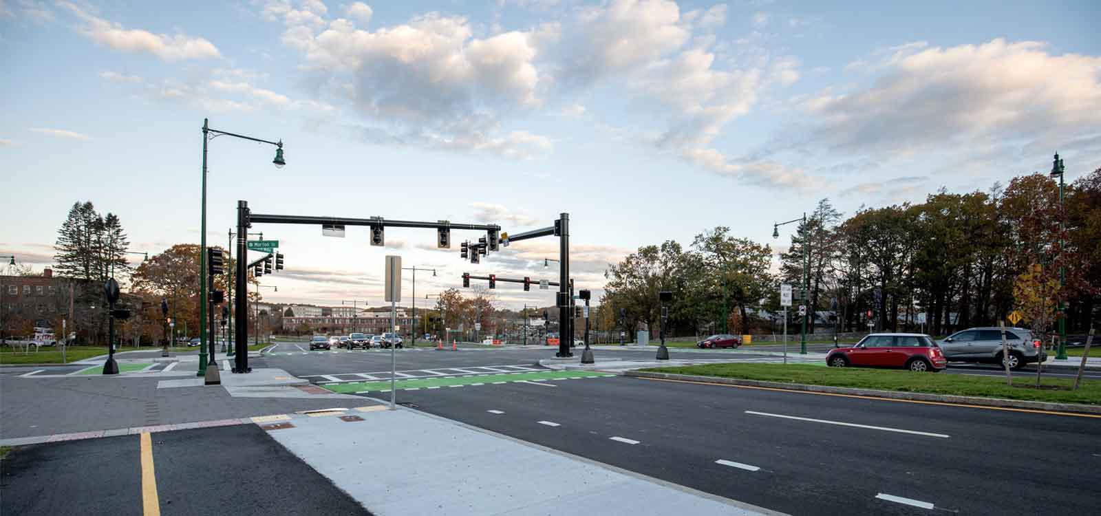
- Reconstruction of 12 intersections
- Construction of a fully accessible north headhouse at the MBTA Forest Hills Orange Line subway station
- Reconstruction of the MBTA upper busway canopy and construction of the busway extension structure
- Replacement of the MBTA Orange Line tunnel emergency ventilation system
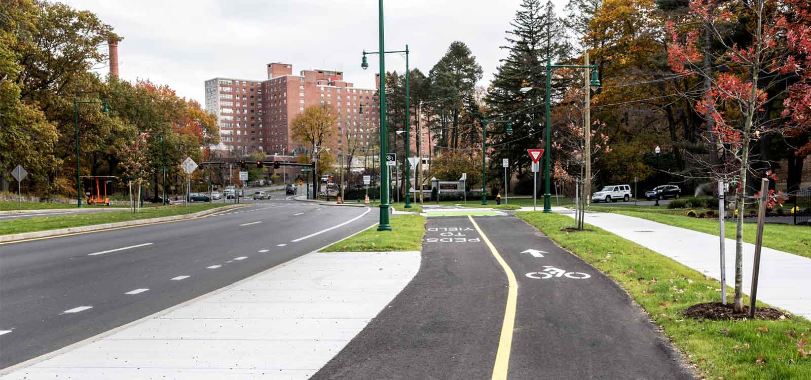
- Expanded and widened 4 miles of sidewalks and paths
- Improved pedestrian desire lines and accessibility.
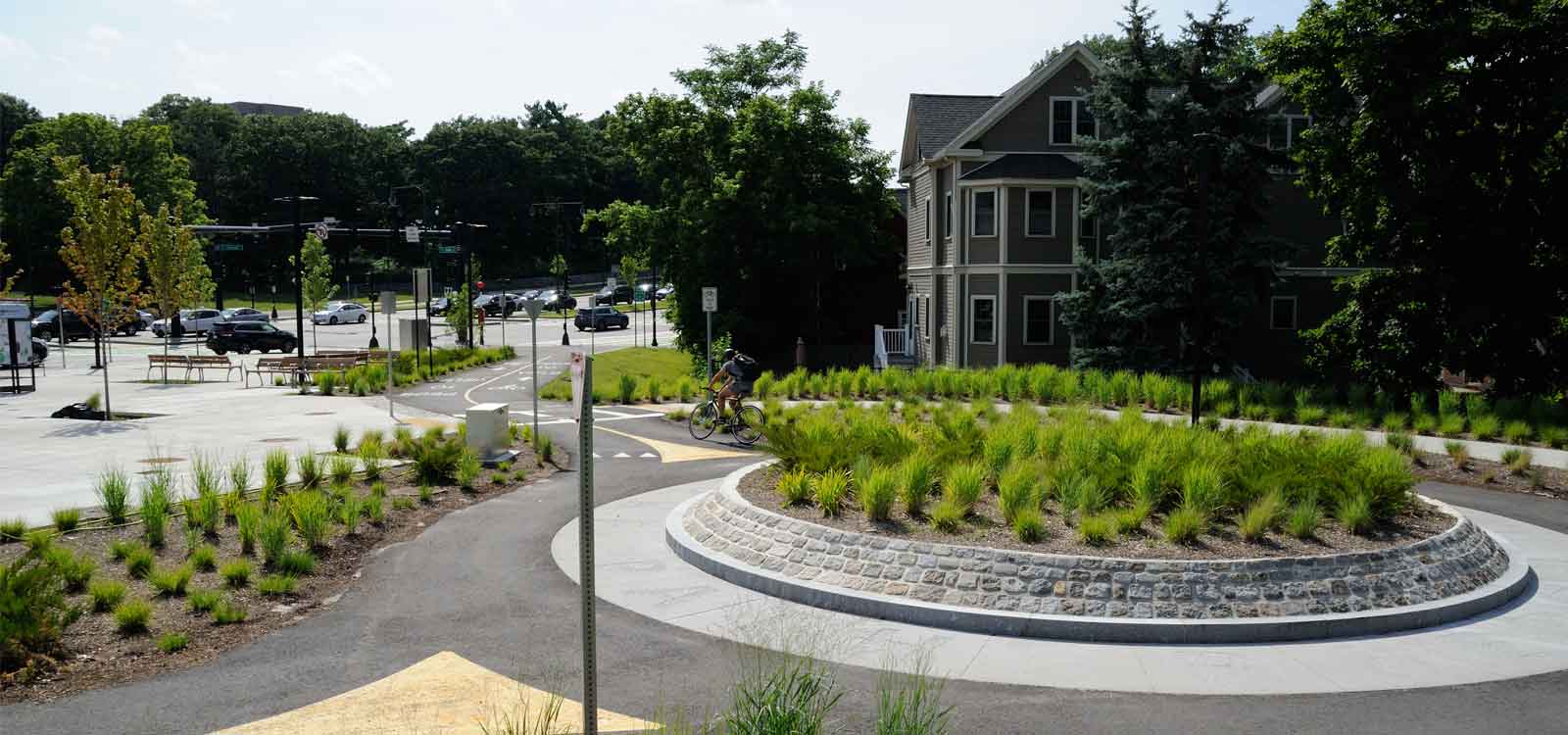
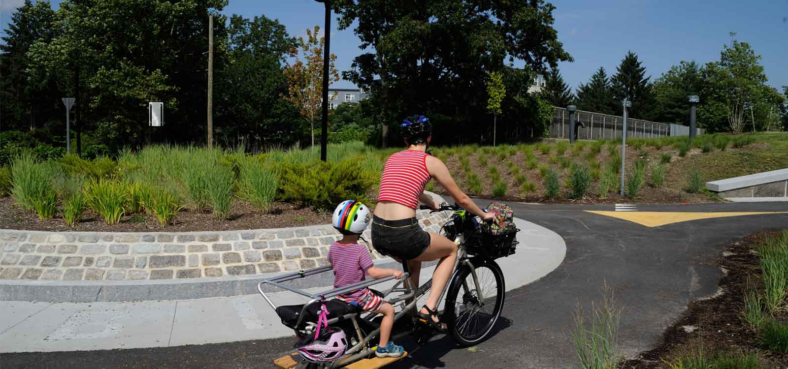
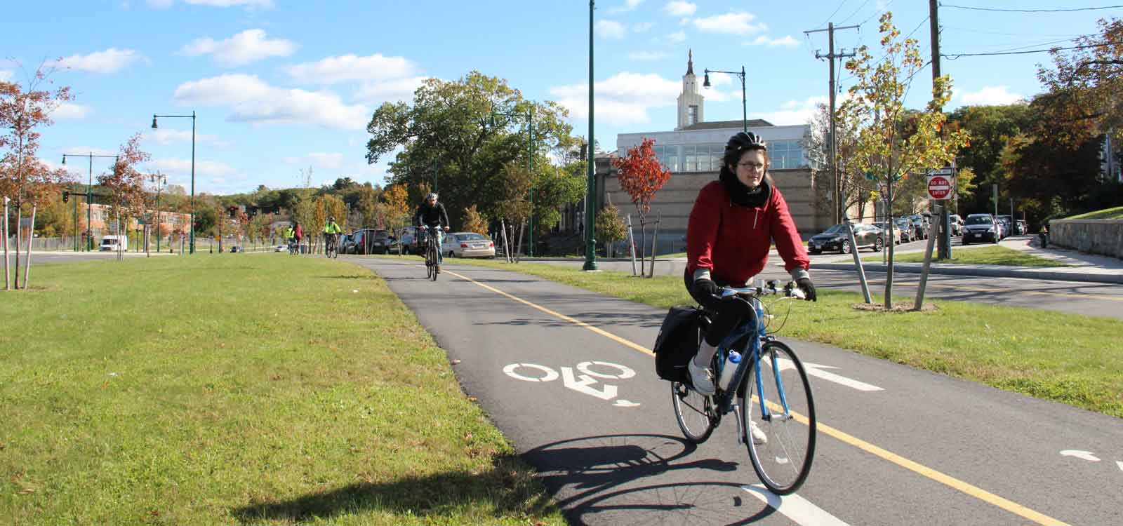
- Three miles of new off-street bicycle paths
- Connecting the Southwest Corridor Park paths to the Arboretum and Franklin Park, removing a critical gap in bicycle infrastructure.
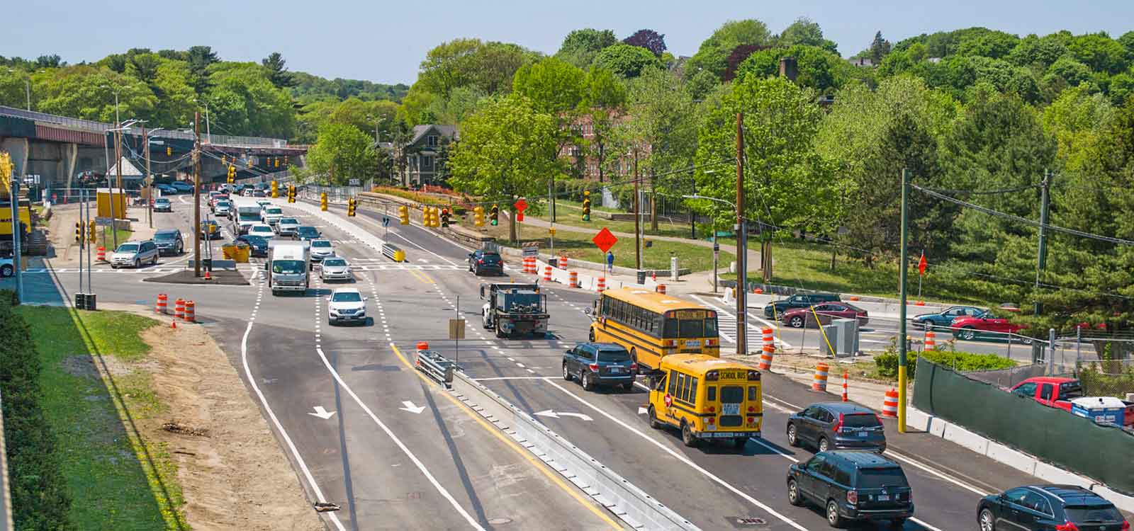
Deadlines drive debate
In 2009, the Massachusetts legislature approved the Accelerated Bridge Program, which would reduce a backlog of structurally deficient bridges, with the stipulation that projects be completed by September 2016 to qualify for funding by the program.
“That stipulation meant designated funding and a designated drop-dead date to build,” said Andrea d’Amato, assistant secretary of MassDOT. “That rule made the project very real for people, because they knew that they were going to see it get done.”
Passionate communities and stakeholders emphatically made their interests known.
“In Massachusetts, people take the right to speak their mind pretty seriously,” said Steve McLaughlin, MassDOT project manager. “HNTB helped us identify those communities, reach out to them, and use collaborative planning and agendas to advance the design process.”
Eventually, that process included a 30-person advisory task force representing neighborhoods, regional advocacy groups, and multiple city and state agencies.
“The community provided input and challenged the team to make balanced design choices that benefited all stakeholders,” Kapust said.
Transforming transit
“We asked the community what they wanted us to focus on most and, almost unanimously, it was transit,” d’Amato said.
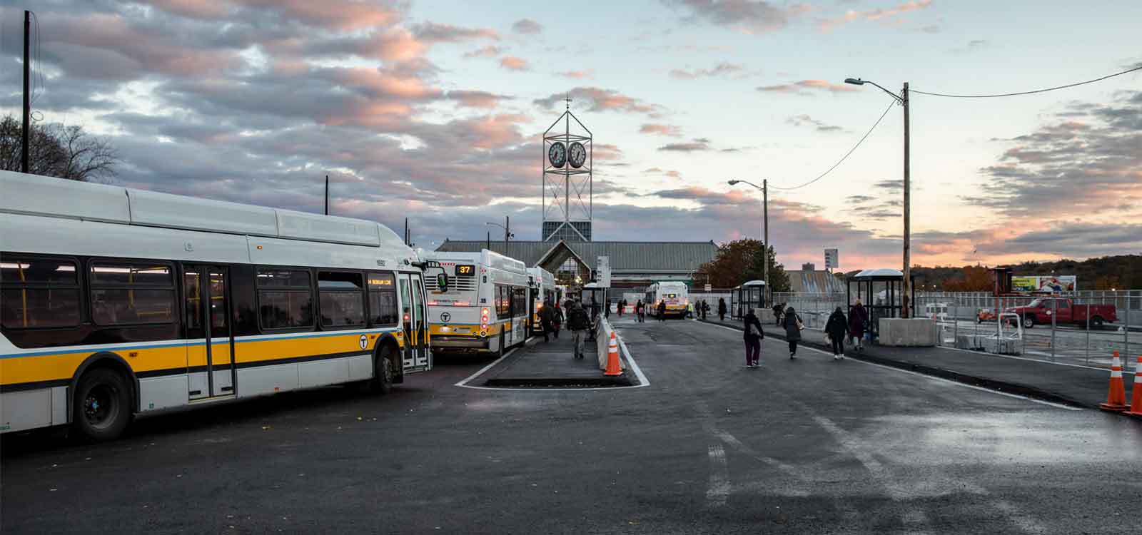
Removing the overpass and relocating a surface roadway allowed the subway rail platform for the MBTA’s Orange line to be extended and updated, and a new headhouse to be built. Customers are no longer forced to cross a street to access the platform, and the resulting plaza is now available for other uses.
After an origin destination study (forecasting to 2035), two major intersections were redesigned so that left-turning traffic passes straight through, making a U-turn offset from the cross-street, then turning right onto the destination street. As a result, the intersection can handle more traffic, and signals were coordinated to maximize traffic throughput.
“The new pattern improved connectivity and access for all modes,” Godfrey said. “The area was opened up and better connected with the neighborhoods, as well as with people traveling to and through the space.”
A new network of bicycle and pedestrian facilities — three miles of bike path and more than four miles of pedestrian path — separate from each other and motor vehicles, was created, and development of a roundabout equalized bicycle movement and removed pedestrians. Now, there is an uninterrupted path for riders commuting from the neighborhoods south of Forest Hills to downtown Boston.
Improvements above, and below
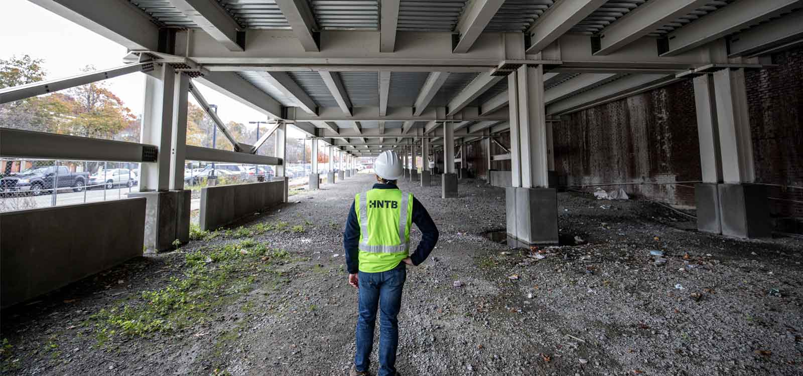
A large bus network also traverses the space, so the upper busway was relocated and expanded to consolidate route locations. A 22,000 square-foot bus canopy now aligns with new expansion deck columns and existing Massachusetts Bay Transportation Authority tunnel wall, sheltering buses and customers. Reconfigured school bus pickup and drop-off points improved safety and eliminated traffic backups on surrounding streets.
Underground, the rail tunnel contains the terminus of the MBTA Orange Line, a commuter rail station, as well as pass-through points for Amtrak’s Northeast Corridor, so significant modifications were required to accommodate the new design.
A new drainage system was installed on top of the tunnel. Grates cast into the curb connect to multiple small pipes running to the original outlet points and drainage chases. Geofoam blocks under the new landscape grading limit loading on the tunnel, and the old vent grates (12 open holes totaling 2,000 square feet) were closed from above by using a variable depth integral concrete slab designed to accommodate decreased loading of the new roadway. Finite element analysis with staged construction loadings were used to design the integral slab, and to prevent the composite structure from overstressing the existing components of the tunnel structure.
The plan called for a new emergency ventilation system using six jet fans to be attached to the tunnel ceiling, but there was a hiccup: the new fans would not arrive for 18 months, and demolition of the old ventilation system could not begin until they were in place.
“We worked to reverse the entire project staging and build from the project limits into the center, where the station is located,” Kapust said. “The contractor was able to complete large sections on-time, and the community had finished paths and roadways to get excited about.”
Public comment to public satisfaction
The Casey Arborway project was extraordinary in ways that went beyond its scale and complexity.
The surrounding communities have a long history of robust public involvement, and MassDOT and HNTB held and led more than 40 public meetings and workshops. The advisory task force of citizens and interested parties were given “homework,” such as photographing what they wanted to see in the project and mapping desire lines for walking, driving and biking, which were incorporated into presentations. MassDOT and HNTB truly partnered with the stakeholders by proactively engaging with, and responding to, their love for their community.
“They realized that they could be very creative and that we were open to it, and it was a very rewarding experience,” d’Amato said. “It worked, and with a complex set of diverse and divergent community interests. This was one of the hallmarks of the project in MassDOT’s eyes, and it changed our approach to public engagement.”
The stakeholders who made up the working and design advisory groups included:
- Arboretum Park Conservancy
- Arborway Coalition
- Arborway Committee
- Arborway Gardens Condominium Complex
- Asticou Martinwood South Street Neighborhood Association
- Asticou Neighborhood
- Boston Cyclists Union
- Boston Police E-13 Traffic and Parking Committee
- Brookside Neighborhood Association
- Community Planning Committee for the Arborway Yards
- Emerald Necklace Conservancy
- Franklin Park Coalition
- Jamaica Hills Association
- Jamaica Pond Association
- JP Business & Professional Association
- JP Neighborhood Council
- Livable Streets Alliance
- Lower South Street Neighborhood Association
- Orchardhill, Bremen Terrace, and Lennoco Road Neighborhood Association
- RozzieBikes
- South Street Safe Neighborhoods
- StonyBrook Neighborhood Association
- Sumner Hill Association
- WalkBoston
- West Roxbury Courthouse Neighborhood Association
- Woodhaven/Colbert/Regis Neighborhood Association
"I participated in the planning and the public debate. I'm a close neighbor, and I walk through the project area three or more times a week for exercise. We've got blue sky where an ugly and unnecessary overpass was, and now you can see how Forest Hills got its name.” – Clay Harper, Emerald Necklace Conservancy's Advocacy Committee
“The bike facilities included in the Casey Arborway redesign project are some of the highest quality in the entire city. They’ve increased the safety and accessibility for people on bike and foot around the Forest Hills area.” – Eliza Parad, Interim Executive Director, Boston Cyclists Union
Reconnecting the Necklace
Boston’s Emerald Necklace spans more than 1,100 acres, forming a chain of six parks linked by greenways and waterways, designed in 1870 by the father of landscape architecture, Frederick Law Olmsted. The name comes from the way the chain appears to hang from the neck of the Boston peninsula, and attractions in the parks include sailing, hiking, sports, Harvard University’s Arnold Arboretum and a zoo.
The Arborway is a link between two of the “gems” of the necklace, Franklin Park and the Arboretum.
“While the overpass stood, there wasn’t a safe and accessible route for pedestrians and cyclists traveling between the two,” said Evan Bradley, marketing and communications coordinator for the Emerald Necklace Conservancy, a private non-profit stewardship organization that maintains, restores and protects the parks.
“We had four stated goals in the development for the plan: reconnecting the parks; accommodating all users; respecting the spirit of Olmsted’s original vision; and creating livable streets for abutting neighborhoods,” Bradley said. “The Casey Arborway looks ahead to a future with less focus on automobiles and more on people. Also, and in the very best ways, the new plan respects the fabric of the Necklace and will become a valued part of the park system that we know, love and defend.”
Anticipating change
Planning considered future growth and development.
“Certainly this project and access to the train station has made land around Forest Hills much more viable, and that land had been on the books for an awfully long time,” d’Amato said.
In fact, development of a number of parcels surrounding the project began before the project was even completed.
“The area is going through a renaissance,” McLaughlin said. “As soon as the bridge came down, developers were knocking on the city’s door to get permits.”
New developments range from mixed-use retail and commercial projects, multi-family units and single-family homes, all radiating out from the transit hub.
In addition to man-made changes to transit pathways, the Forest Hills neighborhood has almost two more acres of open space, more than 500 new trees, and a streetscape design with permeable pavers and green space that allow water runoff to reach plantings.
“The area has been transformed, and it’s wonderful,” McLaughlin said. “Now, you see things that you couldn’t before: the clock by the transit station, the spire of a church and the courthouse. You’re on the Emerald Necklace, and it’s been re-woven into the fabric of Forest Hills. We were able to transform a neighborhood, and we did it by listening and doing our homework and paying attention, and that’s really something.”
CONTACT
Paul Godfrey
HNTB's Design Project Manager
(207) 228-0890

Jonathan Kapust
HNTB's Engineering Lead
(617) 532-2246
SEE MORE ARTICLES
MORE DESIGNER STORIES
US 290 Program
INDYGO RED LINE
ALLEGIANT STADIUM
CHAMP CLARK BRIDGE
ORLANDO INTERNATIONAL AIRPORT, SOUTH TERMINAL